





 Turkish
 Italian
 Spanish
 Portuguese
 Romanian
 Albanian
 Lithuanian
 Latvian
 Bulgarian
 Greek
Greek Hungarian
 French
 Croatian
 Czech
Czech
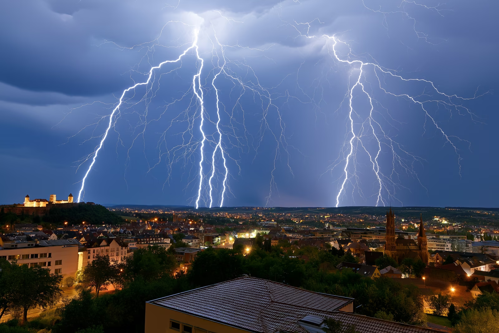
After a week of temperatures above 30 degrees Celsius, the heat over Franconia ended with a bang. On the evening of July 14, 2026, a massive thunderstorm cell rolled over Nuremberg, Fürth and Erlangen, flooding streets, stripping roofs and pelting parts of the region with hail up to six centimeters across. The Nuremberg storm triggered around 3,000 emergency calls within five hours, a number the fire department says the city’s control center had never seen before. Days later, commuters were still feeling the consequences, above all on the S1 S-Bahn line towards Hartmannshof.
A Record Night for Emergency Services
The integrated control center in Nuremberg, which handles calls for the city and surrounding districts, logged roughly 3,000 emergency calls between the early evening and late night. Around 270 fire brigades with up to 3,000 responders worked through approximately 1,000 individual operations across Nuremberg, Fürth, Erlangen and neighboring districts: pumping out flooded cellars, clearing fallen trees, and securing damaged roofs.
Several people were injured during the storm, one of them seriously, according to ZDF. The regional outlet inFranken reported that Nuremberg airport temporarily halted operations at the height of the storm and that at least one primary school canceled in-person lessons the next morning because of storm damage. Police and fire services asked residents to stay indoors and keep emergency lines free for life-threatening situations.
How Severe the Nuremberg Storm Was
The numbers behind the Nuremberg storm are remarkable even by the standards of recent German summers. At the rain gauge in the northern district of Buchenbühl, 44.0 millimeters of rain fell within just 15 minutes. On the twelve-level German heavy-rain index, the Starkregenindex, that equals level 9, which falls into the top category of “extreme heavy rain”, as the Nürnberger Nachrichten reported from the city’s official review of the event.
For comparison: 44 millimeters is more rain than Nuremberg often records in an entire average July week, compressed into a quarter of an hour. Drainage systems in the northern districts of Buchenbühl and Großgründlach had no chance. Add hailstones of up to six centimeters and severe gusts, and the result was blocked roads, smashed skylights and vegetation ripped into power and railway lines across the region.
S-Bahn Line S1 Cut Between Nuremberg and Hartmannshof
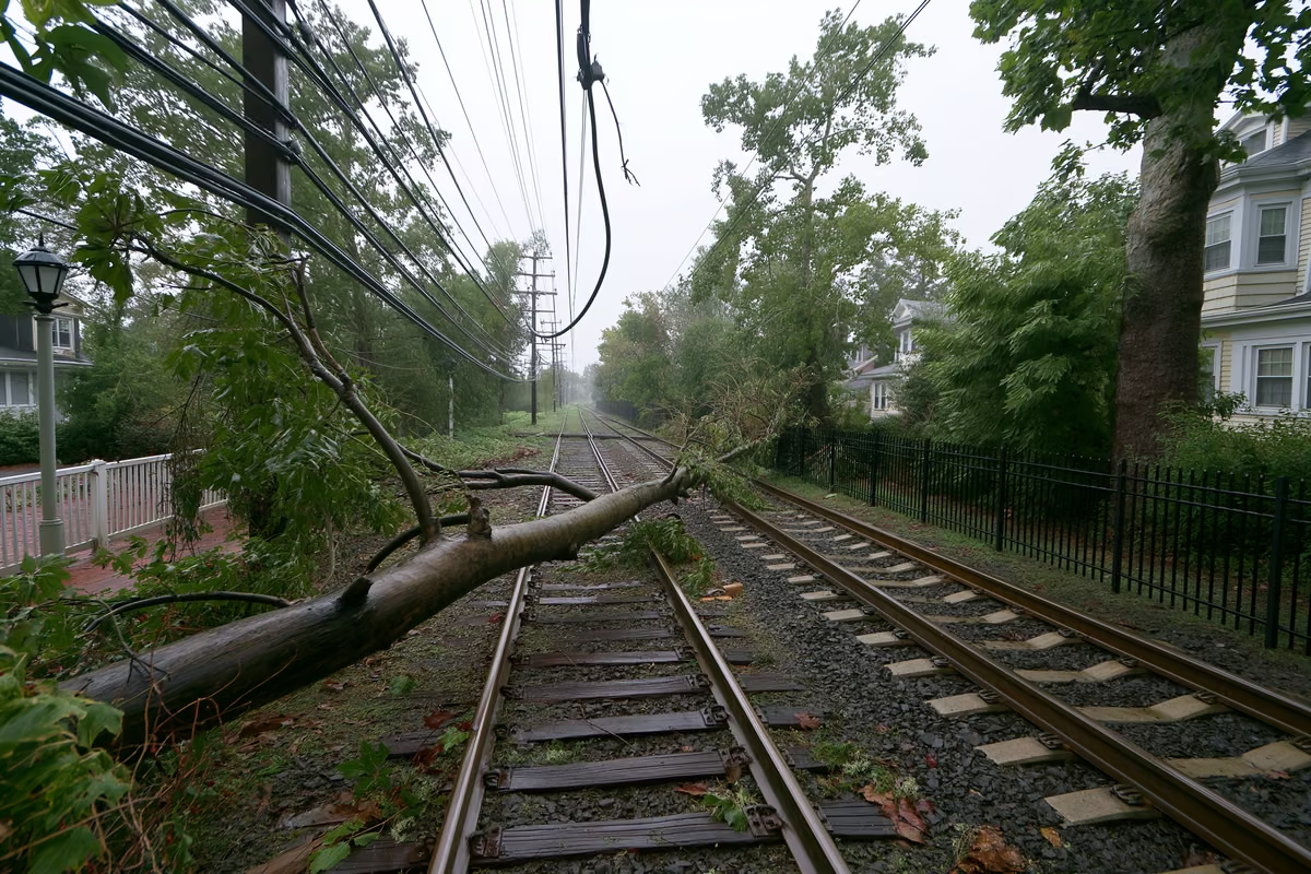
Public transport took a direct hit. On the S1 branch between Nuremberg Hauptbahnhof and Hartmannshof, trees and branches ended up in the overhead power lines, forcing Deutsche Bahn to suspend S-Bahn service on the route. A replacement bus service was set up between Nürnberg-Dürrenhof and Hartmannshof, serving all intermediate stops, though the buses themselves were slowed by blocked and flooded roads in the first days, according to the Nürnberger Nachrichten live traffic ticker.
The storm damage came on top of planned engineering work in the region. On another section of the S1, between Nuremberg and Bamberg, construction is already causing train cancellations with replacement buses during morning and evening hours until July 26, according to the transport authority VGN. Taken together, passengers on Franconia’s busiest S-Bahn line face disruptions well into late July, and anyone commuting towards Lauf, Hersbruck or Hartmannshof should check connections before leaving home.
Why the Nuremberg Storm Fits a Wider Pattern
Meteorologists had warned for days that the July heat wave would end violently. Very warm, humid air masses store enormous amounts of energy, and when a cold front pushes through, that energy discharges in intense, slow-moving thunderstorm cells exactly like the one that hit Franconia. Germany has seen this sequence of extreme heat followed by extreme rain repeatedly in recent summers.
Climate research expects such swings to become more frequent and more intense as average temperatures rise, because warmer air holds more moisture. For residents, that makes basic storm preparedness a normal part of life in Germany: securing balconies, keeping drains clear, and taking official warnings via the NINA and KATWARN apps seriously. Our guide on heat and storms in Germany explains the warning levels and what insurance covers which type of damage.
Getting Around Franconia in the Coming Weeks
If you rely on trains in the Nuremberg metropolitan region, plan extra time until the repairs are finished. Check the DB Navigator app or the VGN website shortly before traveling, since replacement bus schedules can change at short notice and buses take considerably longer than the S-Bahn. For trips towards Hartmannshof, the replacement buses run from Nürnberg-Dürrenhof, not from the main station.
The disruption is also a reminder of how the German rail system deals with storm damage in general: safety inspections of overhead lines and embankments take time, and lines reopen section by section. If a delay of more than 60 minutes hits a longer journey, passengers are entitled to partial refunds under EU rail passenger rights. How tickets, networks and passenger rights work is covered in our overview of the public transportation system in Germany.

